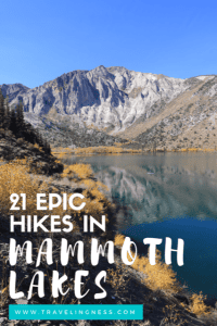
21 Best Hikes In Mammoth Lakes, California You Want To Do
Mammoth Lakes hiking is incredible with an endless number of trails to tackle. There are several hundred miles of trails for you to explore ranging in difficulty and length. There is a trail for everyone no matter your fitness level. The combination of majestic mountains and lakes make for some of the best hikes in Mammoth Lakes and its surrounding area.
I have been to Mammoth Lakes every year since I was a kid, so I’ve had a lot of opportunities to explore many of these trails.
In my most recent trip, I hiked 1-3 trails each day over 3 weeks and I feel like I only put a dent in the number of trails available.

In this post, I’ll share the Mammoth Lakes hikes that are considered easy and moderate in difficulty with a few that were tough.
These are hikes that are the most popular and filled with dramatic views you don’t want to miss.
But don’t fear, if you are looking for extremely hard hikes, you can find many challenging hiking opportunities in Mammoth Lakes.
Keep in mind that none of these hikes I list below are extremely tough per se, but they will feel a lot harder than you expect due to the elevation.
This guide is for hiking in the spring, summer, and fall as trails can’t be accessed in the winter. And who wants to hike miles in the snow…
Tip: Be prepared and have plenty of water with you. The last thing you want is to get dehydrated.
READ: Best Filtered Water Bottles For Hiking!

Need to stock up on hiking gear, explore Essential Gear For Hikers & Adventurers.
Best Hikes In Mammoth Lakes
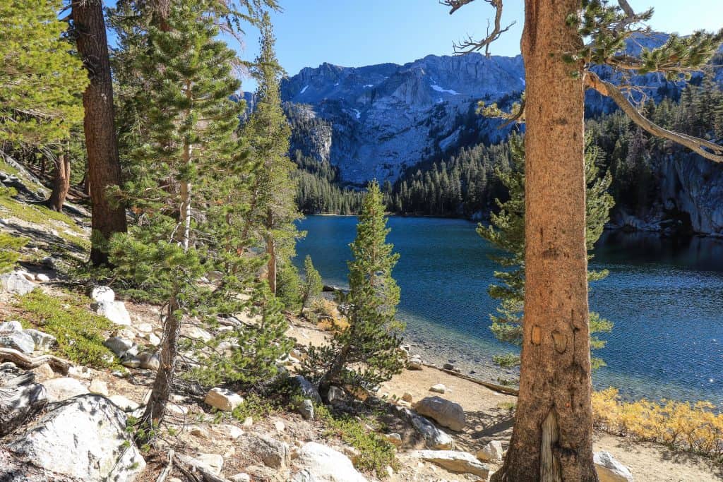
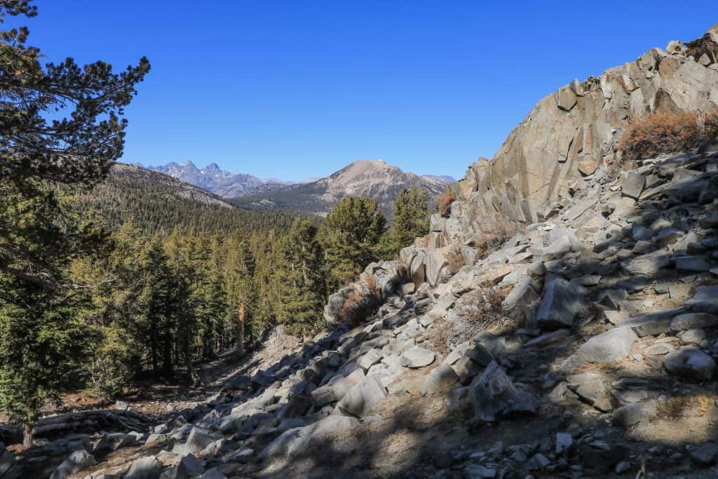
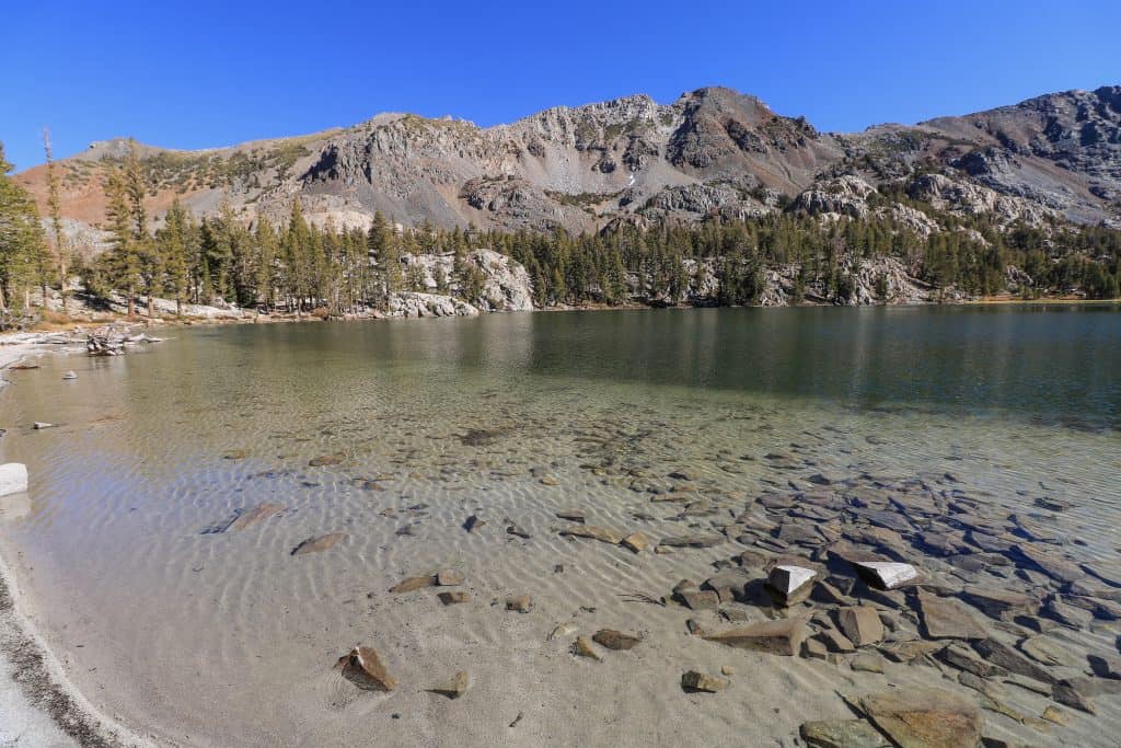
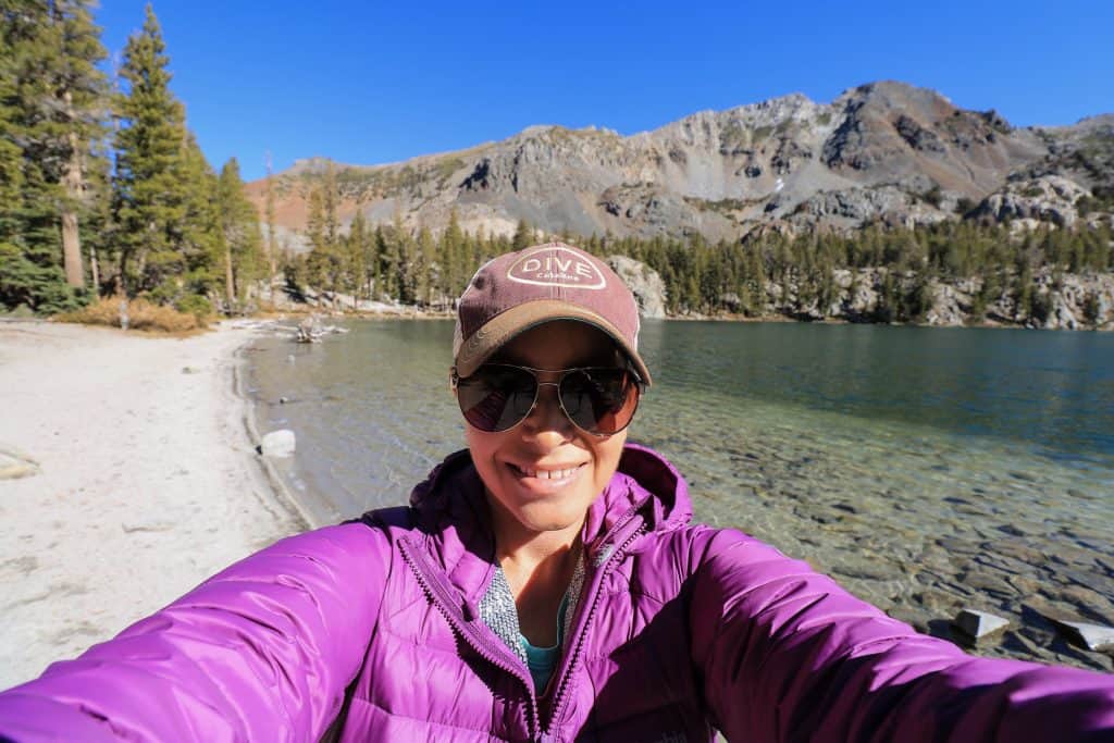
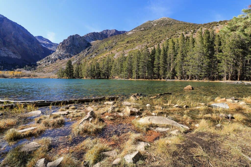
1. Crystal Lake
The 3.1-mile hike to Crystal Lake starts from Lake George and is considered moderate but I thought it was tougher because of the steep climb up.
Expect to spend about 2.5 to 3 hours to hike it roundtrip.


Park at the lot for Lake George and use the restrooms before you take off as there are none on this hike.
The beginning of the Crystal Lake trailhead is on the right-hand side the minute you enter the parking lot.
Once you start onto the trail, you will veer off to the left soon (1-2 mins). I made the mistake of going straight and had to backtrack to get on the correct trail.


From this point, the trail will begin a series of switchbacks up to Crystal Lake.
As you get mid-way up, the views of Lake Mary and Lake George are spectacular below.
It is an excellent spot to take photos and enjoy the beauty of these lakes.

Once you reach Crystal Lake, follow the trail over the creek to the left side of the lake.
There are countless spots to sit along the shore of Crystal Lake and enjoy its serenity. Once you are ready to head back, hike back the way you came!
Starting elevation: 9,250 feet
Elevation climb on hike: 1,127 feet with an ending elevation of 10,337 feet at Crystal Lake
Hike Distance: 3.1-mile out and back trail
2. Lake George
The hike around Lake George is a moderate 1.5-mile loop even though it only has a 104 feet elevation gain.
It isn’t classified as easy because there are some sections that you have to climb through bushes and over rocks.


The trail on about half of it is not as well maintained as all the other lakes in the area.
Just know that you might encounter some mud, shrubs, and rocks on a portion of it.
You won’t miss out if you only walk on half of it starting from the parking lot and walking along the left-hand side towards Lake Barrett.

I recommend combining this hike with the next one on the list that goes to Lake Barrett and TJ Lake.
The only restrooms are by the parking lot before taking off.
Starting elevation: 9,250 feet
Elevation climb on hike: 104 feet
Hike Distance: 1.5-mile loop
3. Lake Barrett & TJ Lake
Hiking to Lake Barrett and TJ Lake is great to do if you are at Lake George and have done the loop around it.
It isn’t a long distance to see two more scenic lakes so you might as well do it!
Starting from the parking lot at Lake George, follow the trail and signs to Lake Barrett & TJ Lake.
It is a 1.5-mile out and back hike with a small amount of elevation gain.


As you walk around the left side of Lake George, the path will take you through a forested area before climbing up.
The first lake you will come upon is Lake Barrett which is a pretty small lake.
But don’t let its small size deter you from stopping a few minutes to admire its beauty. I loved capturing the reflections of trees on the water’s surface.
If you continue on the same trail past Lake Barrett, you will reach TJ Lake in minutes.
Once you reach the lake, it is a short incline down to be at the lake’s shore.
There is a good chance you might have the whole lake to yourself! It is a lovely lake that is very quiet and peaceful.

Starting elevation: 9,250 feet
Elevation climb on hike: 314 feet, the highest point at 9,564 feet
Hike Distance: 1.5-mile out and back
4. Lake Mary
Lake Mary is the largest lake and has the most amenities in the Lakes Basin area.
This is a super easy hike, more of a walk as there isn’t any noticeable elevation gain.
Having said that, it is a really nice walk with constant idyllic views the entire way around the lake.
As a kid, I used to camp and fish every year at Lake Mary with my family. If you are looking to fish, this is one of the best lakes in the area for it.
The fish you will likely catch the most of are rainbow and brown trout. And in case camping isn’t your thing, they have cabins for rent too!


There isn’t a distinct path to follow around the lake as a lot of it is walking on the road along the lake and campsites. You can start at any point around the lake as you will be making a loop.
There are numerous places to walk down to the water’s edge and if you want a little extra workout you can kayak out on the lake too.
Starting elevation: 8,966 feet
Elevation climb on hike: 59 feet
Hike Distance: 2.2-mile loop
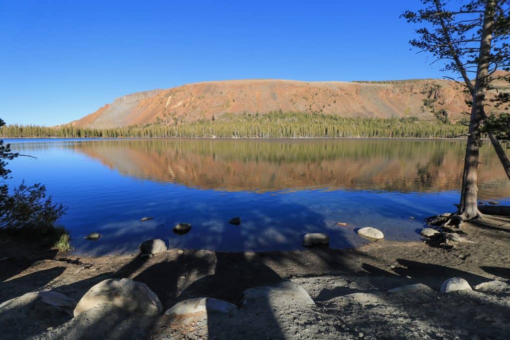
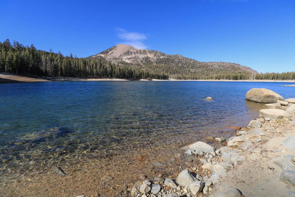
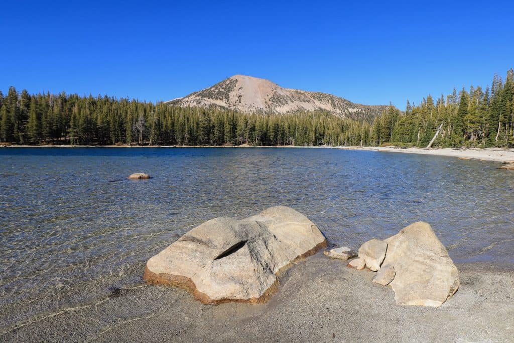
5. Horseshoe Lake
Hiking around Horseshoe Lake is pretty easy with minimal elevation gain. For me, the elevation gain really determines how hard a hike is no matter the distance.
But you are in luck as Horseshoe Lake is enjoyable without getting exhausted.

Once you park in the lot, there are bathrooms available before you head out on the 1.8-mile loop.
You will notice that there is a trail leading out to your left and one along the lake.
The Horseshoe Trail starts out along the lake which is clearly marked with a sign.

The other trail on the left that leads through the dead looking trees is the Mammoth Pass and McLeod Lake Trails.
The dirt trail of Horseshoe Trail will take you around the lake with many small wooden bridges and creeks to cross.

As you continue and come to the road, cross the street and see Twin Lakes from above.
After enjoying the view, go back across the street and continue on the path back to Horseshoe Lake.
From this point, the trail is asphalt and you will take this path all the way back to where you started.

Note: It took me 1.5 hours but that was stopping several times to take photos and sit for a bit. If you are keeping a good pace you can easily complete in an hour.
Starting elevation: 8,996 feet
Elevation climb on hike: 114 feet
Hiking Distance: 1.8-mile loop
6. McLeod Lake
The start of the McLeod Lake trail is at the same parking lot for Horseshoe Lake.
I recommend doing both as they are right next to each other and combined are 3.6-miles in total.
McLeod Lake might be one of my favorites as far as its beauty goes. Although it seems like my list of favorites is growing!

From Horseshoe Lake parking lot, look to the right where you see the dead trees to begin the hike to McLeod Lake.
Curious as to why the trees here are all dead?
In the 1980s a number of earthquakes in the area caused a disruption resulting in exceptionally high levels of carbon dioxide.
The roots of the trees need oxygen and when they don’t get any they die. So that being said, this area isn’t a good place to spend a lot of time at or lay down and take a nap.
The high levels of carbon dioxide could affect you if you were to stay too long. I was there for about 1.5 hours and felt completely fine FYI…

The hike to McLeod Lake from Horseshoe Lake parking lot is a ½ mile but if you walk around the lake and back it totals 1.8 miles.
I love how there are a number of logs and boulders along the lake that add to the photos.
Starting elevation: 8,996 feet
Elevation climb on hike: 351 feet
Hiking Distance: 1.8-mile loop
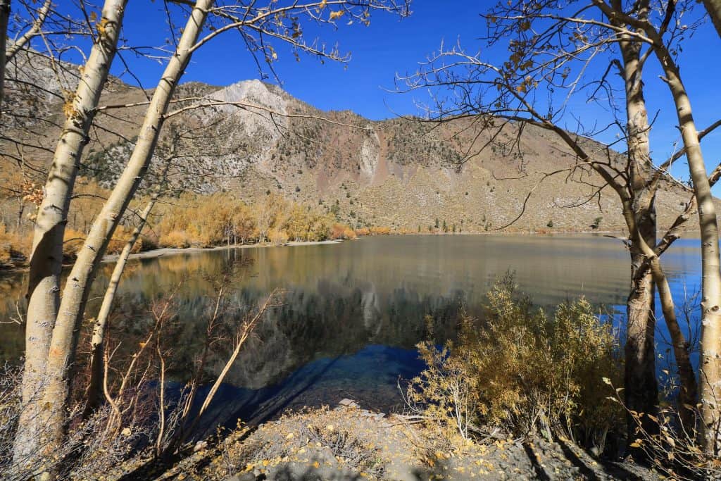
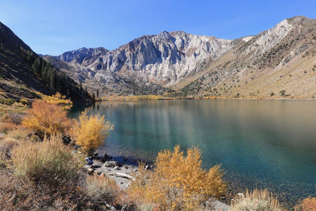
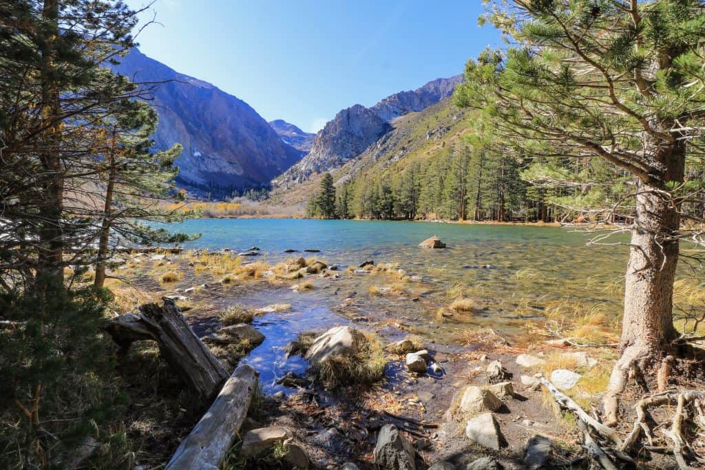
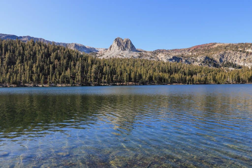
7. Convict Lake
So, I know I already mentioned some of my favorites, but if I had to pick only one, Convict Lake would be it.
Why? Well, besides it being breathtaking, you will likely have that “oh wow” moment when you arrive.
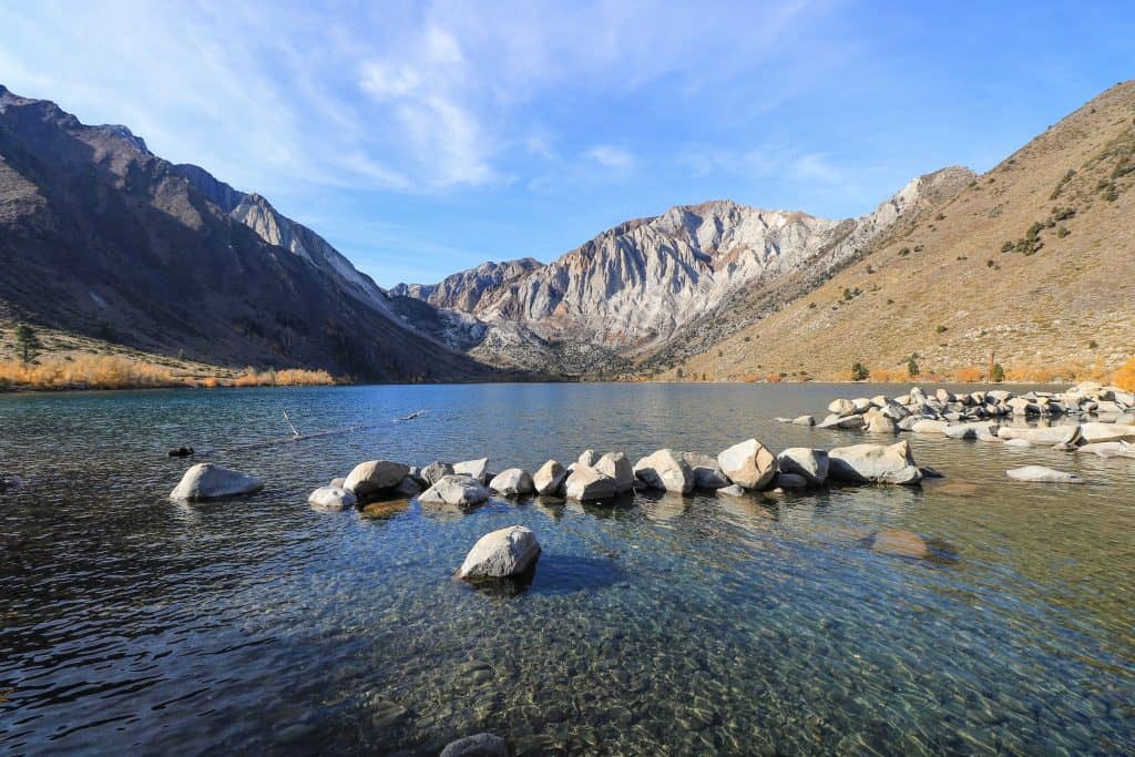
The mountains that surround the lake are steep and truly magnificent.
After parking, enjoy taking some photos along the lakefront before hopping on the trail on the right-hand side (at end of the parking lot).
The 3-mile loop is fairly easy and offers up spectacular views at every angle around the lake.
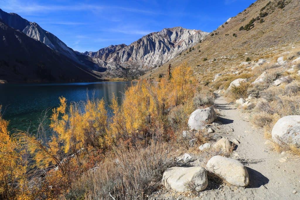
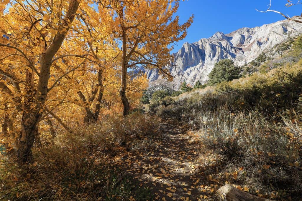
If you are visiting in the fall, it is an extra treat to see the leaves changing colors. Vibrant yellows and oranges are bursting with fall delight.
At the middle point, you will notice a few small footbridges to cross small creeks that might be running.
It is here that you will walk through a grove of Aspen trees. Continue around the lake to where you began!

Are you curious as to why it is called Convict Lake? Back in 1871, some convicts (prisoners) escaped from a prison in Carson City, Nevada.
The sheriff tracked the convicts down to what is now the area of Convict Lake.
That incident resulted in the sheriff getting killed. The mountain peak above the lake was named after him, Mount Morrison.
Despite its darker history, it is the prettiest lake with crystal clear water that won’t disappoint no matter when you visit.
Starting elevation: 7,850 feet
Elevation climb on hike: 213 feet
Hiking Distance: 3-mile loop
Note: Convict Lake is about 30 minutes south of Mammoth Lakes located on Convict Lake Rd off of Highway 395. It also has excellent camping and fishing!
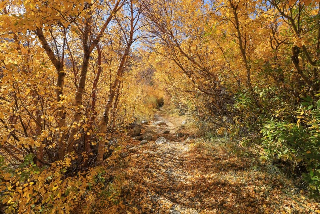
8. McGee Creek
If you are spending the morning or midday at Convict Lake, head over to McGee Creek after.
McGee Creek runs through McGee Creek Canyon taking you on a scenic trail carved out between the mountains.
It reminds me a bit of when I visited Scotland, the same terrain and beauty.

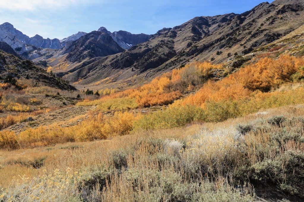
Aspen trees line the entire path of the creek and are on fire during the fall with intense yellow colors.
The Aspen trees are easy to spot with their clusters of vibrant colors.
As you hike, you will see Mount Aggie and Mount Baldwin straight ahead sitting dominantly with their sharp peaks.
Almost like the gatekeepers to this canyon.
At the 1.8-mile point (half-way), you can turn around or continue on to add more distance to your hike.

If you want a more challenging hike, keep going to Steelhead Lake (10 miles RT) or to Big McGee Lake (14 miles RT).
Both the hike to Steelhead and Big McGee Lake would be considered difficult.
There is also camping available back closer to Highway 395 (you pass it on the way to the trailhead).
The trailhead for McGee Creek is about 15 minutes south of Convict Lake off McGee Creek Road.
Starting elevation: 8,000 feet
Elevation climb on hike: 718 feet, 2,522 feet (Steelhead Lake), 2,860 feet (Big McGee Lake)
Hiking Distance: 3.6-mile out and back, Steelhead Lake (10-miles), McGee Lake (14-miles)
9. Devil’s Postpile
Devils Postpile National Monument is one of those natural rock formations that is a wonder to see.
Taking Highway 203 that runs through Mammoth you will reach Devils Postpile at the end of it expecting about a 30-minute drive.
After parking, Devils Postpile is an easy 0.8-mile trail (1.6-miles round-trip) that takes you to the base of Devils Postpile.

Looking up, you can admire the basalt columns that were formed about 82,000 years ago from cooled basalt lava.
The specific composition of minerals allowed it to form into what looks like perfectly symmetrical and hexagonal columns.

It is quite amazing how they all formed so uniformly and right next to each other.
Many of the columns that you see have fallen over but the ones still standing vertically are up to 60 feet tall!
As you continue on the path, you will see a sign after Devils Postpile on your left leading up to the top of it.
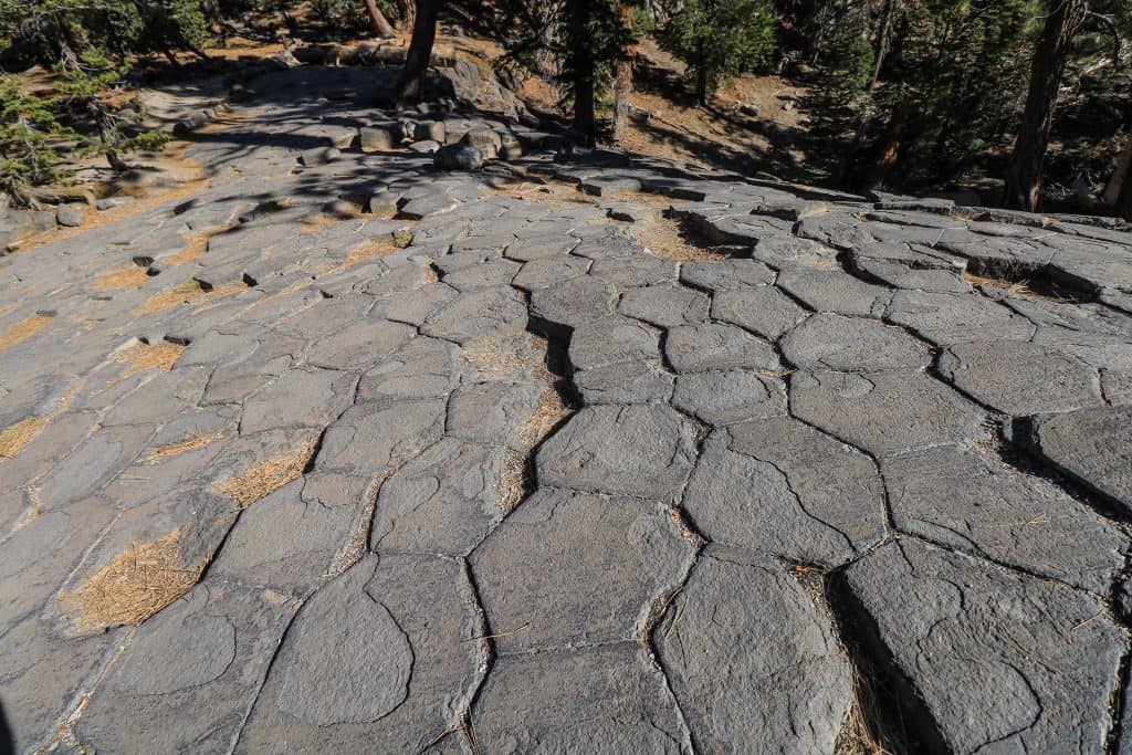
Make sure you don’t forget to go to the top! The perspective from above shows how the tops of the columns look like a bunch of pavers from your backyard patio.
You can come down on the opposite side and head back down and towards the beginning.
Note: The only restrooms are at the Ranger Station parking area for Devils Postpile.
Starting elevation: 7,560 feet
Elevation climb on hike: 246 feet
Hiking Distance: 1.6-miles out and back
Parking: If you go in the spring or fall, you can drive down and park at the Devils Postpile Trailhead. If you go in the summer from mid-June to the beginning of September then you MUST park at the Mammoth Mountain Main Lodge near the Adventure Center.
10. Rainbow Falls Trail
If you are up for a longer hike, then continue on the same path from Devils Postpile towards Rainbow Falls.
It is a 5-mile roundtrip trek (that includes the distance of Devils Postpile from the Ranger Station).
And if you go further down to Lower Falls add another 1.3-miles for a total of 6.3 miles.
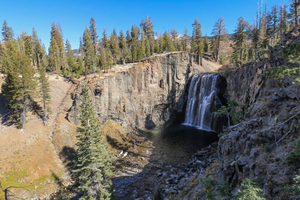
The trail is clearly marked as it runs through a forest and then into open fields until you arrive at Rainbow Falls.
Once you get to the falls, there is a viewing platform looking down at the 101-foot waterfall.

And if you are lucky, you will view a rainbow hovering in the mist when the sun is shining on it, hence its name.
If you want to get a more up close and personal viewing, continue straight past the viewing platform and take the staircase that leads down to the bottom of the waterfall.
After you have had your fill of the waterfall, head back up the stairs and follow the signs to Lower Falls. Instead of going back the way you came, you will turn right down the path.
When you arrive at the Lower Falls you can either climb down the boulders on the side or a dirt path on the far left.
This is the perfect location to sit, relax and enjoy the spectacular views of the Lower Falls.
Even though it is much smaller, I liked it more than the bigger Rainbow Falls. Probably because I was the only one there and it was so peaceful.
Fun Fact: Rainbow Falls is the tallest waterfall in the Eastern Sierras at 101-feet!
Note: The only restrooms are at the Ranger Station parking area for Devils Postpile.
Starting elevation: 7,560 feet
Elevation climb on hike: 528 feet
Hiking Distance: 5-miles out and back, add 1.3-miles if you go all the way to Lower Falls
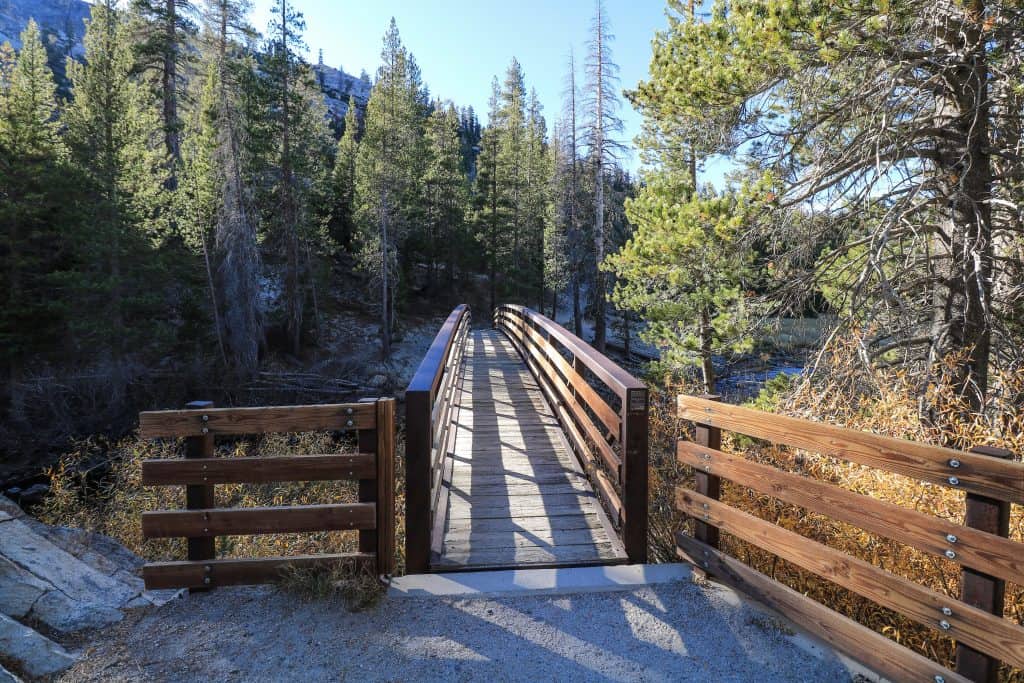
11. Minaret Falls
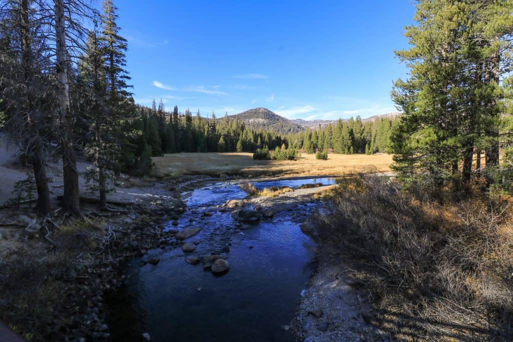
The hike to Minaret Falls is very beautiful as it starts out over a creek, through meadows, and then in a forest.
As much as I loved this hike, I would recommend going in the spring and early summer so that you actually get to see water falling!
In mid-October, it wasn’t much more than a trickle as it is the driest time of year.
I was pretty disappointed with the falls but to be fair I was there when the least amount of water is flowing.
Access to Minaret Falls is via the same parking lot for Devils Postpile and Rainbow Falls.
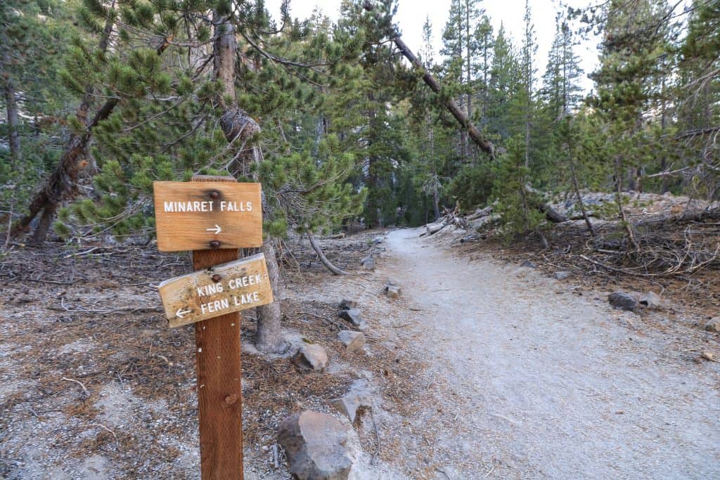
Begin walking towards Devils Postpile until you see the sign to turn right in the direction of Minaret Falls.
The trail is fairly easy but you do need to be able to cross rocks and small creeks at some points.
Starting elevation: 7,560 feet
Elevation climb on hike: 269 feet
Hiking Distance: 2.6-miles out and back
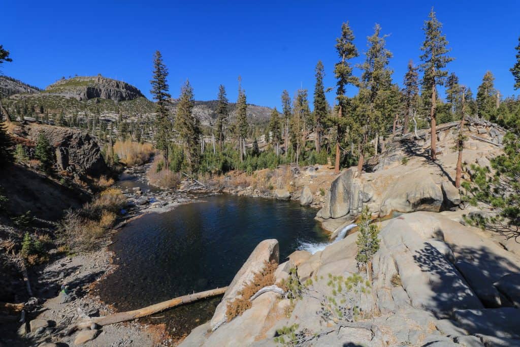
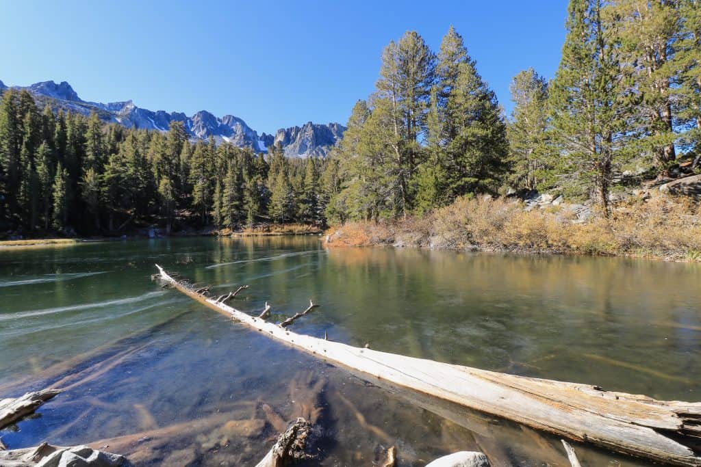
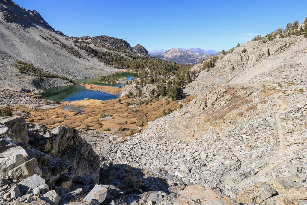
12. Skelton Lake
The hike for Skelton Lake is 3.1-miles that begins at the Duck Lake Pass Trailhead. This trail will take you all the way to Duck Lake and Pika Lake.
I highly recommend going to Duck Lake that includes #13 and #14 below.

From Mammoth Lakes, take Lake Mary Road and turn left onto Lake Mary Loop Rd, about 15-20 minutes.
Continue until you come to Cold Water Creek Campground Road. Turn left and past the campgrounds is a parking lot.
You have two options to hike to Skelton Lake with the Duck Pass Trail on the left. The trail you see over to your right is Emerald Lake Trail.
Either trail is fine as they meet up a little way before Skelton Lake.

I chose to hike in on the Emerald Lake Trail and returned via the Duck Pass Trail to see some different landscapes.
Hiking on the Emerald Lake Trail will take you past the small Emerald Lake. At the end of October, the lake was starting to freeze over!

Continue past Emerald Lake and merge onto Duck Pass Trail with Lake Skelton shortly after.
I feel like a broken record in saying yet another gorgeous lake, but it is!
Keep walking on the trail to a rock overlook for a sensational viewpoint. At this point head back to the trailhead unless you want to keep going to the next lakes.
Starting elevation: 9,087 feet
Elevation climb on hike: 872 feet
Hiking Distance: 3.1-miles out and back
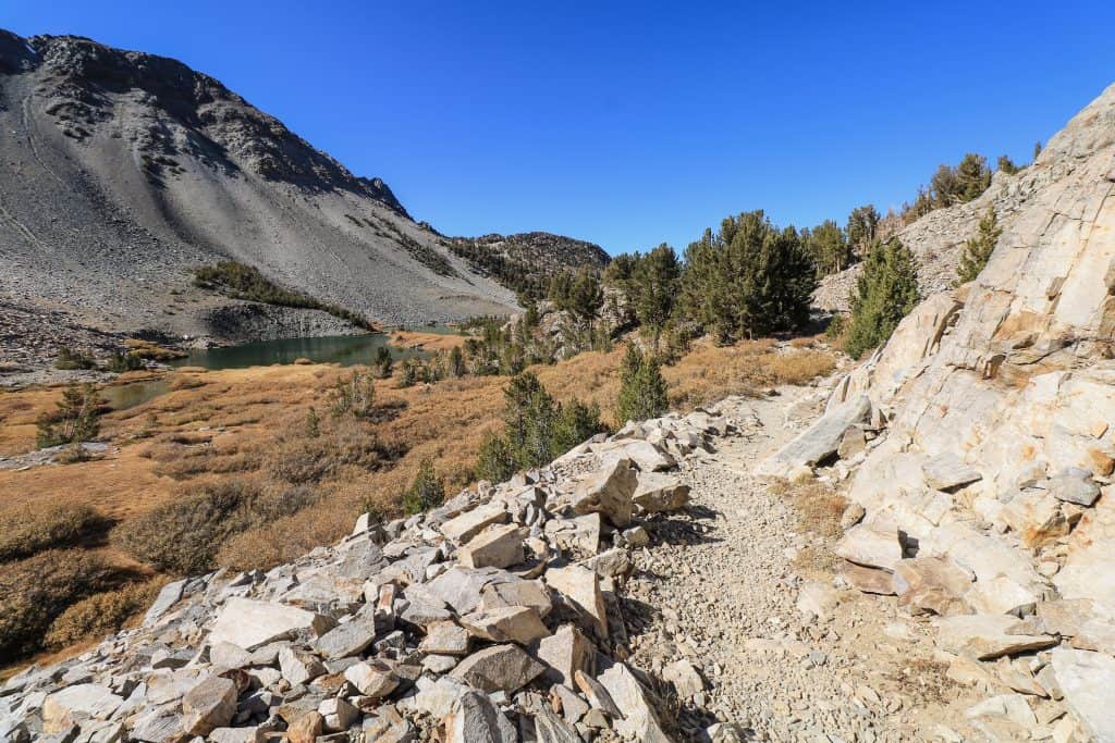
13. Barney Lake
The hike to Barney Lake begins at the same trailhead as the Skelton Lake hike (#12 above).
After taking Duck Pass Trail to Skelton Lake, continue on Duck Pass Trail to Barney Lake. A little over a mile from Skelton Lake, you will come across Barney Lake.
The trail to Barney Lake is a nice dirt path that takes you through a pine forest until it opens up to a meadow at Barney.

You can’t walk completely around Barney Lake as the trail only goes along half of it. It is a scenic spot if you want to take a few minutes to rest and have lunch.
Up until this point, the incline is consistently gradual so it isn’t noticeably difficult.
From Barney Lake, you can return back to the trailhead or continue on to Duck Lake and Pika Lake. Do it! That is if time allows and you don’t mind a tougher climb up to it.
This hike is considered moderate but like many other hikes the part that can be a struggle for some is the increase in altitude as you are above 9,000 feet.
Note: If you decide to continue on to Duck Lake I would rate it as difficult because of the steep incline from Barney Lake and the high elevation.
Starting elevation: 9,087 feet
Elevation climb on hike: 1,177 feet
Hiking Distance: 5.4-miles out and back
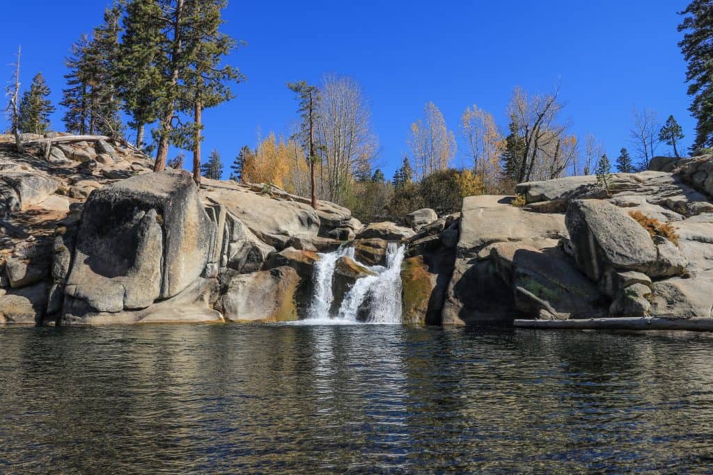
14. Duck Lake
The hike up to Duck Lake and Pika Lake is phenomenal for the beauty and sensational views.
But keep in mind that the incline is steeper as you zig-zag along the switchbacks up to the top of the mountain peak.
The hike up to Duck Lake is 10 miles round trip that starts at the same trailhead for Skelton and Barney lakes.
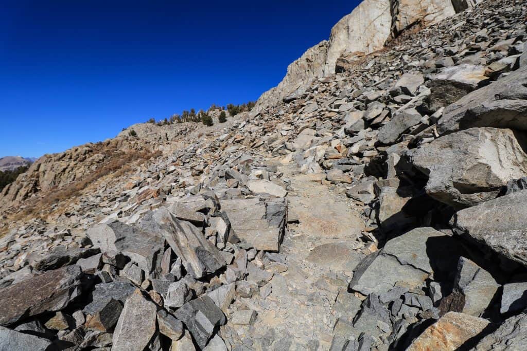
The terrain up after leaving Barney changes from a forest and vegetation to very rocky bare cliffs.
As you move along each switchback, make sure to turn and gaze back down at Barney Lake. Just when you thought the view can’t get any better, it does!
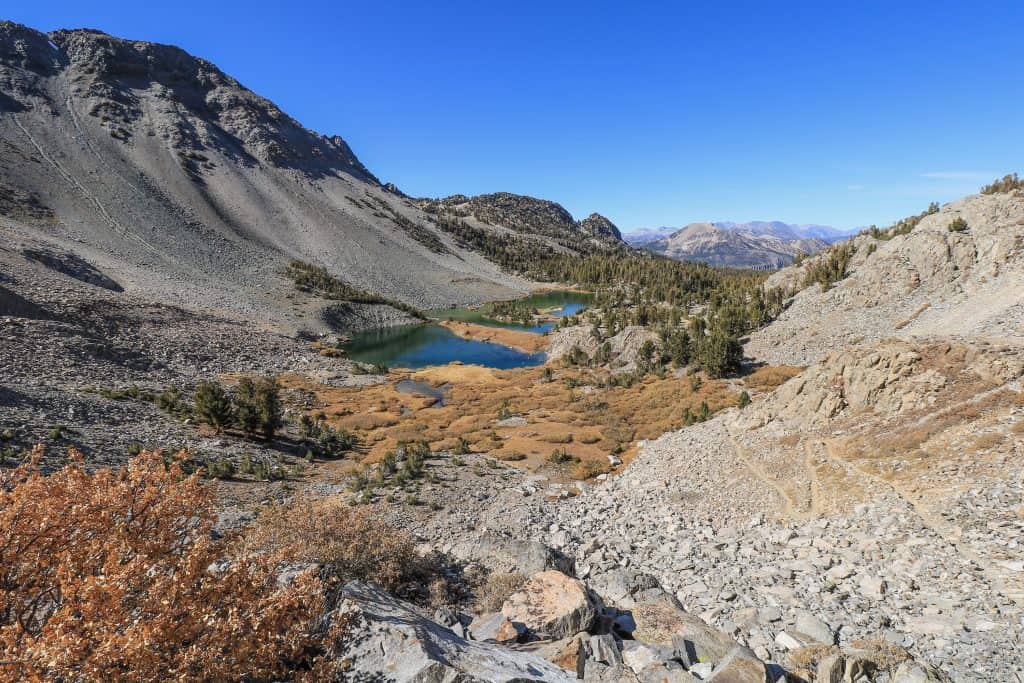

You are able to see Barney and Skelton lakes in the valley and the Mammoth Mountains encircling them.
Once you reach the top, it will level out before you get a glimpse of Duck Lake sparkling below.
You can turn right and follow the trail along Duck Lake or veer to the left around Duck Lake to arrive at the charming Pika Lake.
As mentioned above, if you hike up the Emerald Lake Trail, hike back on the Duck Pass Trail to the parking lot. You don’t have to but it gives a different experience!

As you pass Skelton Lake there is a trail to your right that will take you to Arrowhead Lake. It is a small lake that not surprisingly is shaped like an arrowhead!
Arrowhead is just a few minute’s walk off of Duck Pass Trail. Duck Pass Trail is one of many hikes in Mammoth Lakes that should be a must!

Note: If you are really ambitious and want to tack on another 2.4-miles to your day, venture over to Heart Lake that starts from a trailhead next to the Duck Pass Trail.
Starting elevation: 9,087 feet
Elevation climb on hike: 1,680 feet
Hiking Distance: 9.5-miles out and back
15. Gull Lake (June Loop)
By now you are probably realizing there are seriously the most epic hikes in Mammoth, right?
Hiking Gull Lake might not be tough but it is a lovely trail that loops around passing meadows, groves of aspens, and the sparkling lake view.
Gull Lake is one of four lakes that makes up the June Loop about 30 minutes north of Mammoth Lakes off the Highway 395.

Start the hike at Gull Lake Park where there is a playground, basketball courts, and bathrooms.
If you make your past the small park and walk along the right side of the lake, you will see the beginning of the trail.
The trail will take you through a somewhat marshy area in a meadow before heading into a tiny grove of aspens.

If you are visiting in the fall, this is the place to be to see fall’s changing colors. Well anywhere around the June Loop will have vibrant yellows and oranges on display!
Past the aspen trees and along the lake’s shores there is a rope swing. If it is a hot summer day how fun it would be to swing into the lake for a refreshing dip!

As you make your way around back towards the start, you will pass campsites and cabins before returning to the marina and docks at Gull Lake.
Gull Lake is a great spot to rent a boat or kayak no matter whether you fish or not.
A few times I almost went off the trail but was able to correct with the AllTrails app.
Note: Looking for a great bite to eat? Head over to June Lake Brewing Company or Ohanas 395 which parks at June Lake Brewing Company.
Starting elevation: 7,610 feet
Elevation climb on hike: 124 feet
Hiking Distance: 1.9-mile loop
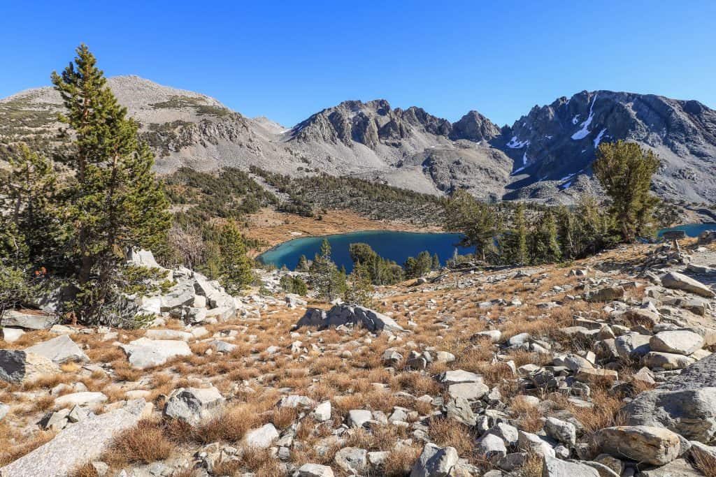
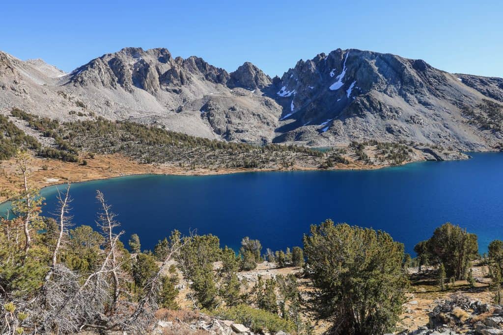
16. Parker Lake
I would recommend hiking Parker Lake after visiting the June Loop as it is fairly close and makes for another great picturesque hike.
The drive is about 20-30 minutes from June Lake but once you turn onto Parker Lake Road from Highway 395, expect a very dusty and bumpy dirt road the entire way to the trailhead.
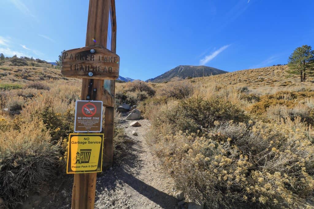

The trailhead is at the end of Parker Lake Road, off of a dirt parking lot. As you begin hiking up the trail, stop every few minutes to turn around and take in awesome views of Mono Lake in the distance.
The trail has a good incline the first ¾ of the way up that will make your heart rate spike for sure!
After that, the trail levels out and is pretty easy as you approach Parker Lake through aspen woods. As you make your way on the trail you will notice Parker Creek running parallel.


The minute you break through the woods and lay your eyes onto Parker Lake you will be having an awe-inspiring “wow” moment!
You can walk in either direction around the lake but the trail isn’t as well defined.
I stuck to walking along the water’s edge on the left and found a perfect log to sit on and enjoy my lunch.

Looking out around Parker Lake, I was in the company of many fishermen spotted here and there.
I was told by one man that it is a great fishing spot (even though he hadn’t caught any at the moment…).
Based on the number of people fishing I would bet that he is right.
Starting elevation: 7,751 feet
Elevation climb on hike: 652 feet
Hiking Distance: 3.8-mile out and back
17. Inyo Crater Lakes
A short drive (about 20 mins) from Mammoth Lakes along the Mammoth Scenic Loop are the Inyo Craters.
There are two enormous craters that were formed from eruptions in the Long Valley Caldera about 500-600 years ago.
Today it looks like two sunken holes that are now lakes with turquoise green water. Go earlier in the day to see the light hit the water and display the prettiest colors!

Once you park your car, there are two trails that will take you to the craters. Either one works as you can go in and out or form a loop and come back via the opposite trail.
The walk to the craters is a 1.6-mile, fairly easy and takes you through a tranquil forest that is well shaded.

Hiking on the far side of the craters doesn’t have a super clear trail and is steep so you can always just walk around the side closest to you and capture great views.
There is even a viewing observation area to see the 200 feet deep crater lakes.
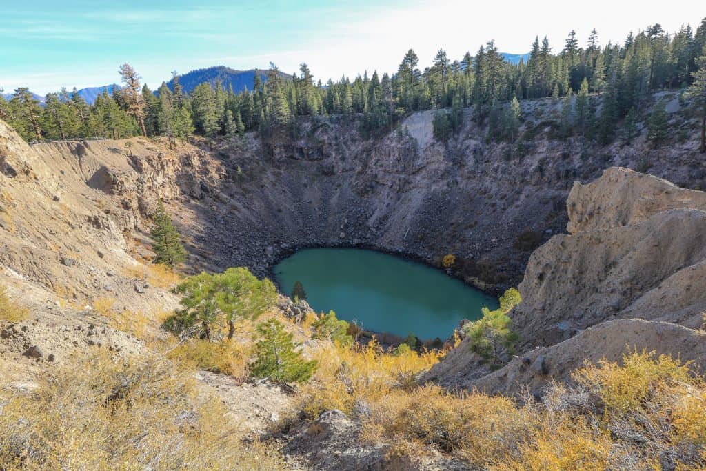
Note: From Mammoth Lakes take Minaret Rd (203) in the direction of the Mammoth Mountain Ski area. Turn right onto Mammoth Scenic Loop and after a few miles and then turn left onto a dirt road to reach the Inyo Craters parking area.
Starting elevation: 8,075 feet
Elevation climb on hike: 295 feet
Hiking Distance: 1.6-mile loop
18. Panorama Dome Trail
The Panorama Dome Trail might be a short distance but don’t be fooled, this is a bit challenging for the steep climb in minutes.
The trek up to the summit of Panorama Dome will surprise you with a 360-degree view of the Mammoth Lakes Basin, the town of Mammoth Lakes and the Long Valley Caldera in the distance.
The start of the trailhead begins off of Lake Mary Road up and across from the Twin Lakes vista point parking lot. It is also a little ways past the turnoff to Twin Lakes.
Starting elevation: 8,621 feet
Elevation climb on hike: 288 feet
Hiking Distance: 0.7-mile out and back
19. Minaret Vista Trail
The Minaret Vista Trail is a moderate 2.6-mile hike to the Minaret Vista Summit.
The Minaret Vista Trail begins behind the Mammoth Mountain Inn and takes you to the Minaret Summit for some spectacular views.
As in the name, the prominent peaks of the “Minarets” are in full view at the summit.
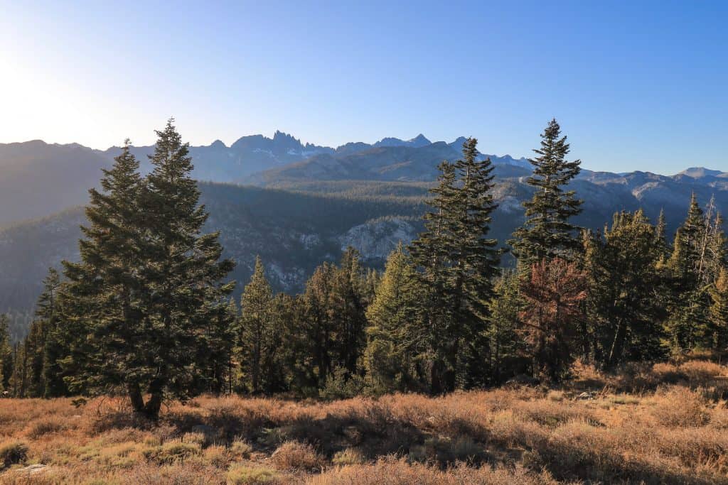
The Minarets are a number of jagged sharp peaks on a mountain range in the Ansel Adams Wilderness. They are immediately recognizable for their distinct shape.
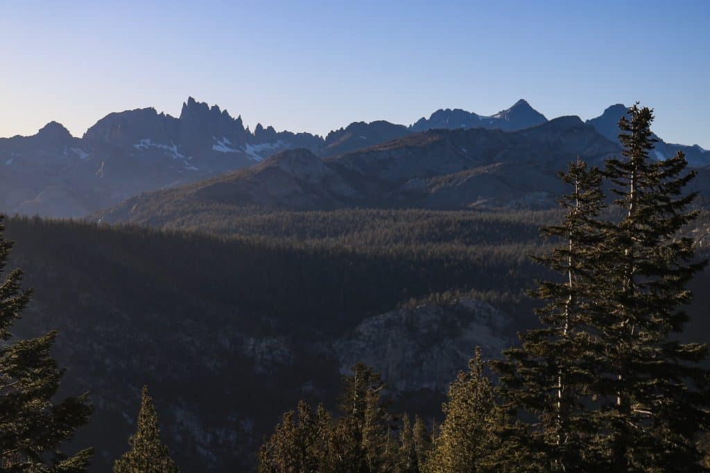
If you ask a local, one of the best places to watch the sunset is at Minaret Summit Vista. There are two ways you can reach the vista point, drive or hike.
If you are short on time and not up for a hike, then you can drive all the way up to the parking lot at the Minaret Summit Vista.
Starting elevation: 8,903 feet
Elevation climb on hike: 246 feet
Hiking Distance: 2.6-mile out and back
20. Sotcher Lake Loop
I didn’t get the chance to hike the 1.5-mile loop around Sotcher Lake as the roads to it were closed for the season.
Although I hiked it many years ago, I don’t have any current photos to share. If the roads are open, this is a great hike to do after Devils Postpile and/or Rainbow Falls.
This easy hike is awesome to do any time of the year but if you go in September and early October, you get the chance to see the fiery colors on the trees and foliage.
Sotcher Lake is adjacent to Reds Meadow and is one of the most scenic spots in this valley.
Starting elevation: 7,586 feet
Elevation climb on hike: 183 feet
Hiking Distance: 1.7-mile loop
21. Walker Lake
Another hike that I really wanted to do but ran out of time is Bloody Canyon to Walker Lake Trail.
It is very close to the Parker Lake Hike above and could be done on the same day depending on your schedule.
From looking at photos and talking to locals, Walker Lake is a beauty! To access this trail, turn left onto Oil Plant Road off of Highway 395 heading north.
Starting elevation: 7,267 feet
Elevation climb on hike: 636 feet
Hiking Distance: 4.8-miles out and back
Where To Stay In Mammoth Lakes
There are numerous places to stay in and around Mammoth Lakes but some great choices with good location are:
The Village Lodge – this is an excellent choice especially if you are staying in the winter as you can catch lifts right next to it at the Mountain Center.
The Westin Monache Resort – next to both the Village Lodge and Mountain Center in the Village.
Juniper Springs Resort – located in Mammoth Lakes and a short distance to lifts, lakes, and hiking.
As a second option, there are hotels, campsites, and cabins in June Lake.
Where Is Mammoth Lakes?
Mammoth Lakes is in the Northern California area known as the Eastern Sierras and nestled at the base of Mammoth Mountain.
You will often hear of the town referred to interchangeably as Mammoth, Mammoth Mountain, Mammoth Lakes, and Mammoth Village.
Usually just saying “Mammoth” is fine. Mammoth Lakes is the main town and the Village is next to it where you can access the ski lifts.
The town of Mammoth Lakes is part of Mono County sitting along the Long Valley Caldera and an earthquake fault line.
Because of this, the earth around Mammoth is a geological hotbed with lots of natural hot springs and interesting terrain to see.
The drive to Mammoth from Los Angeles is 5.5 hours, 7 hours from San Diego and 6 hours from San Francisco. That makes it a fantastic mountain getaway from pretty much anywhere in California.
Two famous trails that are the ultimate challenge in the Sierras are the John Muir Wilderness Trail (211 miles) and the Pacific Crest Trail (2,650 miles).
The John Muir Trail runs from the Yosemite Valley down to Mount Whitney passing through Mammoth Lakes.
Only a section of the Pacific Crest Trail runs through the Mammoth area but in some spots, you can walk on both.

Dealing with Altitude Sickness
Not everyone is sensitive to altitude but if you are someone that falls prey to it like me, it can be debilitating.
It is no fun to arrive at your destination in a high altitude location and feel horrible. What are the symptoms of altitude sickness (mountain sickness)?
Symptoms can range from mild to severe with headaches, nausea, shortness of breath, fatigue, and difficulty sleeping.
As you climb in elevation, there is less oxygen for you to breathe in and that impacts your entire body.
You will usually notice the symptoms of altitude sickness within a few hours or the first day at the higher elevation.
The severity of the symptoms will feel more prominent at elevations over 5,000 and even more so above 8,000 feet.
The best thing you can do is rest and give yourself a few days to acclimate to the high altitude.
For me personally, it can take up to a week but I have been that way since I was a kid. For many, you feel back to normal within a few days.
The best way to help your body normalize and reduce the effects of the symptoms is to:
- Avoid alcohol as that will only intensify the symptoms and add to the killer headache.
- Drink lots of water! 3-4 quarts of water per day.
- Eat more carbs! Yep, you heard that correctly. This is the more enjoyable tip to embrace with about 70% of your food coming from carbs.
- Avoid intense physical exercise for the first few days.

Mammoth Lakes Hiking Tips
- Always let someone know where you are going to hike and the time you should return back to town.
- Carry plenty of water! More than you think you will need about 1 Liter for every 2 hours.
- Use this stainless-steel water bottle that keeps water cold or this water purifier bottle to filter germs.
- Drink plenty of water the day before a hike and the morning of so you go into the hike hydrated. Nothing worse than starting a hike dehydrated. It is like trying to take a long road trip with no gas in the tank…
- Have a hiking daypack to carry your essentials and a water pouch if you prefer over a bottle.
- Bring food/snacks but carry only in bear smell-proof bags or containers.
- Bring a hat, sunscreen, and sunglasses as the sun can be intense.
- Wear layers as the weather can change quickly and you want to be prepared for extremely high or low temps.
- If hiking alone carry a bell or something that would make noise to alert bears you are in the area. If you do see one, clap your hands and yell out. Most of the time they will avoid you.
- Carry a physical trail map in case your phone battery dies.
- Use the AllTrails app for guidance on trails. You are able to see if you are on the right path or not.
- Your phone battery might not last all day so carry a chargeable power bank.
- Take breaks, as you will find you will be out of breath and have a higher heart rate than normal at higher altitudes.
- If you are hiking solo or want to stay in communication with others it is wise to carry a satellite communicator.
- Unless otherwise noted, dogs are allowed on a leash on all trails mentioned.
Essential Hiking Gear
Hiking without proper gear can be a real bummer and make each mile much more challenging. Be prepared for your next hike and purchase some hiking essentials.
For a more comprehensive list of essential hiking gear for yourself or another hiker in your life, explore Best Gifts For Hikers & Adventurers!
[col-md-4]

![]()
[/col-md-4]
[col-md-4]

![]()
[/col-md-4]
[col-md-4]

![]()
[/col-md-4]
[col-md-4]
![]()
[/col-md-4]
[col-md-4]

![]()
[/col-md-4]
[col-md-4]

![]()
[/col-md-4]
Best Time To Visit Mammoth Lakes
Deciding when to visit Mammoth Lakes really depends on your interests and what activities you want to do.
There are so many different things to do in Mammoth Lakes year-round with every season offering unique experiences.
But since I am focusing on hiking in this post, the best time to go is mid-May to November.
Any other time of the year will be cold, covered in snow, and most if not all trails will be inaccessible.
If your priority is to see waterfalls and snow-capped mountains go in the spring or early summer.
For the warmest temps visit in the summer and for fall foliage don’t miss going in September through early November.
Got Travel Insurance?
Don’t leave home without travel insurance as you never know what might happen on a trip! It is always when you least expect it that something can go wrong like getting sick, in an accident or cancellation of some sort.
Get a no-obligation quote from two trusted travel insurance companies for peace of mind on your next trip!
I hope you enjoyed this guide to the most epic hikes in Mammoth Lakes!
Looking For More Travel Inspiration?
17 Best Things To Do In Mammoth Lakes
7 Best Filtered Water Bottles For Travel And Hiking
45+ Awesome Gifts For Hikers & Adventurers
15 Ultimate Solo Hiking Tips For Women
7 Amazing Hot Springs Near Mammoth Lakes
The Best Ways To See Yosemite In The Fall
The Epic California Big Sur Road Trip
The Best Northern California Coastal Road Trip
7 Amazing Places To See Giant Redwoods In Northern California
23 Top Things To Do In Mendocino County For A Weekend Getaway
Samuel H. Boardman State Scenic Corridor: 11 Best Places To Stop